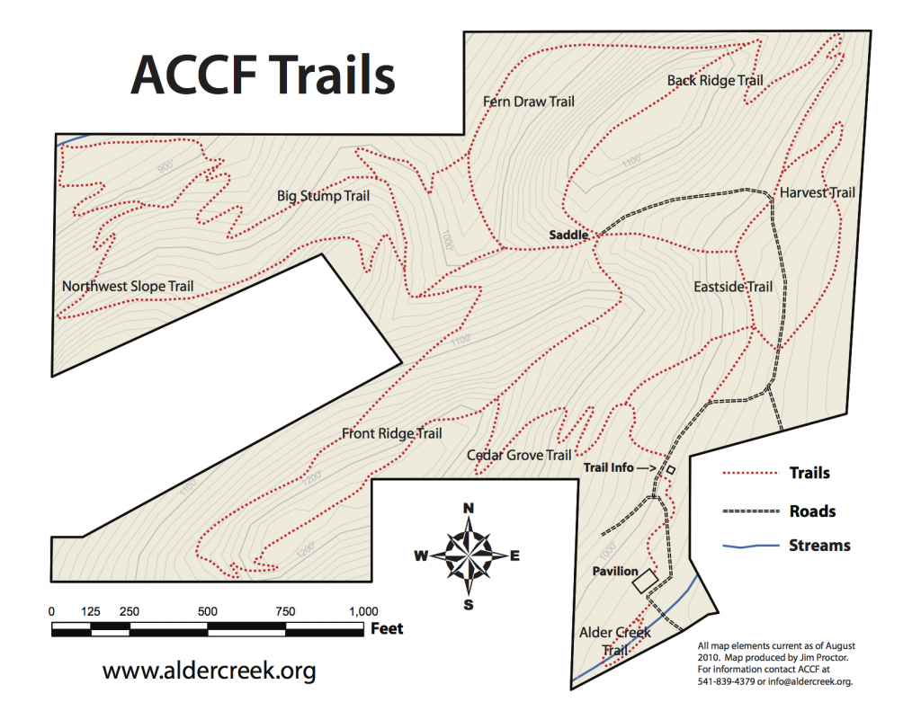
Alder Creek Community Forest has over 3.5 miles of signed trails. Click to view and download a map of all trails (also available in lat/long grid) at right, or download maps below for four recommended hikes! Trails cover the full 78 acre ACCF site, from roughly 850 to 1250 feet in elevation. Some are gentle, while others are quite steep.
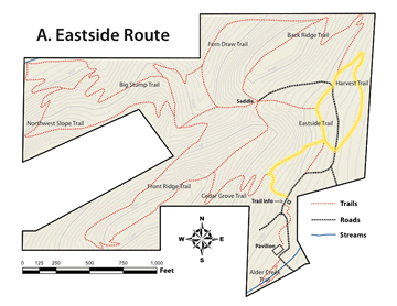
A. Eastside Route
Distance: 0.6 mi
Difficulty: Gentle. A quick hike on relatively level terrain through our eastside forest and regrowth area.
Route: Cedar Grove > connector > Eastside > Harvest > connector > Cedar Grove.
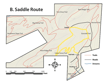
B. Saddle Route
Distance: 0.6 mi
Difficulty: Some climbing. A nice loop up to Front Ridge, then back down via the saddle.
Route: Cedar Grove > Front Ridge > connector > Eastside > connector > Cedar Grove.
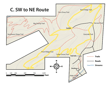
C. SW to NE Route
Distance: 1.6 mi
Difficulty: Moderate. Front and Back Ridge both covered, with a wide range of sun- to shade-tolerant vegetation.
Route: Cedar Grove > Front Ridge > Big Stump > Back Ridge > Eastside > connector > Cedar Grove.
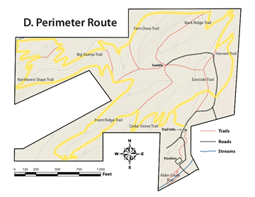
D. Perimeter Route
Distance: 2.7 mi
Difficulty: Strenuous, with lots of climbing. The entire ACCF site is covered in this long loop, revealing the full range of site topography and biota.
Route: Cedar Grove > connector > Harvest > Eastside > Back Ridge > Fern Draw > connector > Big Stump > Northwest Slope > Big Stump > Front Ridge > Cedar Grove.